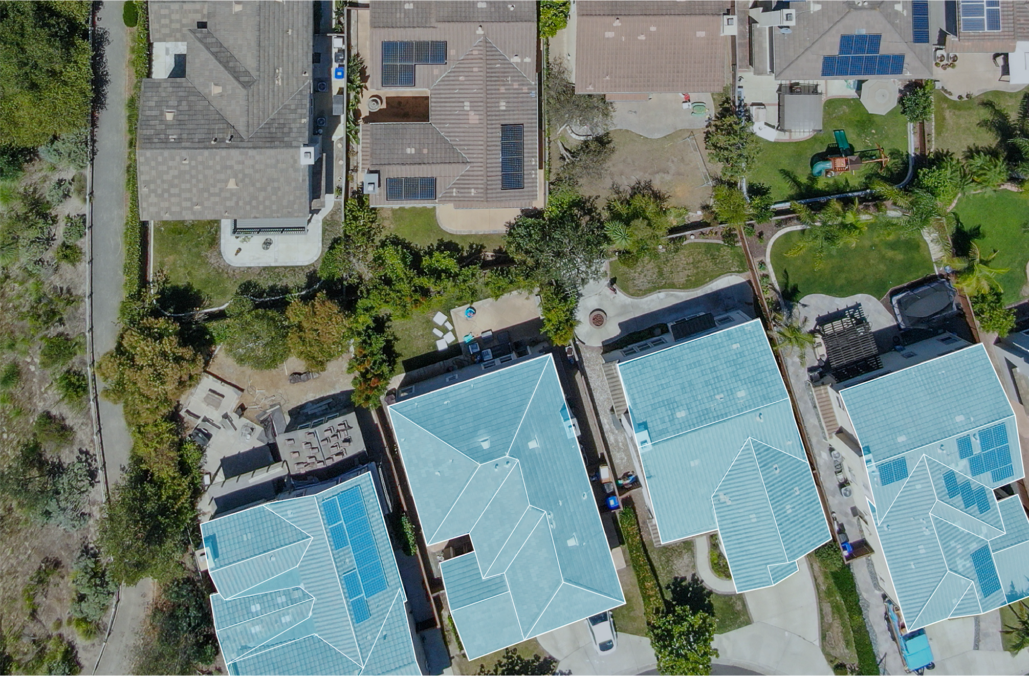
The problem with walking a 60,000-square-foot roof
A large low-slope commercial roof is nearly impossible to read accurately from the ground and painfully slow to read on foot. Crossing every drain basin and lifting every seam by hand on a sprawling warehouse roof eats most of a day, puts traffic on a membrane whose condition nobody has confirmed yet, and still leaves the worst areas hidden — because the parts of a flat roof that pond and trap water reveal themselves from directly overhead, not from a person's standing height. So we fly the roof. A drone captures an even, complete record of the entire surface in a fraction of the time, and it does it without sending anyone onto a roof we have not yet cleared as safe.
What Dayton builds and stores is exactly the kind of roof that rewards flying over walking. Acres of single-ply membrane stretch along the I-75 and I-70 corridors and out toward the logistics buildings near Dayton International Airport. The campuses orbiting Wright-Patterson Air Force Base and the manufacturing plants across the Miami Valley carry roofs broken up by process equipment, screen walls, and dense clusters of curbs. Retail centers in Beavercreek and Kettering spread their roof area across long, shallow planes. On all of them an aerial pass delivers more information, faster, and with less risk than boots ever could.
Thermal imaging reads the water you cannot see from the surface
The most valuable instrument we put in the air on these flights is a radiometric thermal camera, and it works on simple physics. Saturated roof insulation stores and releases heat differently than the dry insulation around it. After a sunny day, as the roof sheds its heat into the evening sky, the wet zones hold their warmth longer and glow against the cooler dry field in the infrared image. We schedule the thermal pass for the cooldown window after sunset, when that contrast peaks, and what comes back is a map of precisely where moisture is trapped in the assembly — frequently across areas where the membrane surface above looks completely intact.
That map rewrites the budget conversation. A roof that looks uniformly worn from the parking lot might turn out eighty percent dry with three saturated bays around a failed drain — a targeted-repair scope, not a tearoff. A different roof might show moisture creeping out of the seams across half its field, which tells the owner that recover or replacement is the honest call and that patching would only entomb the problem. Without the thermal data those are guesses. With it, the spend tracks where the water actually is.
What a combined visual and thermal flight delivers
- Subsurface moisture zones plotted against the roof plan, marked for core-cut verification before any scope is priced.
- High-resolution imagery of every drain, scupper, penetration, curb, and run of perimeter flashing at a consistent altitude.
- Ponding patterns and low spots that only show themselves from straight above.
- Seam, lap, and membrane-surface condition across the full field instead of a sampled walking path.
Documentation an adjuster can verify after a storm
Southwest Ohio sees the full severe-weather menu — spring and summer thunderstorm complexes, hail, and the straight-line and tornadic winds the region knows from hard experience. After a storm, the speed and quality of your documentation drives the insurance outcome more than almost anything else. A drone flight produces geotagged, time-stamped imagery of hail-impact density, wind-lifted or displaced membrane, and damaged rooftop equipment, captured systematically across the entire roof rather than from the handful of spots a person could safely reach on a wet, debris-covered surface.
We assemble that imagery into a report built for commercial property adjusters, with every finding tied to a location on the roof plan so a reviewer can confirm it remotely. For a priority post-event flight we can turn the documentation package around quickly while the evidence is still fresh — which matters, because an adjuster's first question is almost always what the roof looked like the morning after the storm. We document what we observe as a roofing contractor; we do not act as a public adjuster and we do not promise a claim result.
Reroofing numbers built on measured reality
Before anyone writes a reroofing proposal, a flight nails down the facts the specification rides on: true roof area, the count and exact location of every penetration and curb, the footprint of every piece of rooftop equipment, and dated existing-condition photos for the record. Pricing a scope against measured reality instead of an eyeballed walkover cuts the RFIs and change orders that otherwise surface mid-project when the field does not match the assumptions. It also hands the owner a clean baseline to compare competing bids against, because every contractor is then quoting the same documented roof.
Flying legally over Dayton airspace
This is regulated work and we run it that way. Our commercial flights operate under FAA Part 107 with a certificated remote pilot in command. Local airspace demands real attention — the Dayton International Airport area and the controlled airspace tied to Wright-Patterson Air Force Base both require it, and any operation in controlled airspace goes through LAANC authorization or the appropriate clearance before we launch. We maintain visual line of sight, brief the site for people and obstructions beneath the aircraft, and stay inside published weather and wind limits. The entire reason to fly instead of walk is to remove risk, and an unauthorized or careless flight would put it right back.
Common questions from Dayton building owners
Why is flying better than walking the roof?
It covers the whole surface at a uniform altitude with zero foot traffic on an unproven membrane, and it captures what a walkover misses. On any roof above roughly 10,000 square feet a flight is both faster and more thorough, and thermal moisture mapping simply is not practical to perform by hand at that scale.
Can thermal really find trapped moisture?
Under the right conditions, yes. Flown during the post-sunset cooldown, the camera reads wet insulation as warmer than the surrounding dry field. The resulting moisture map is reliable enough to drive a partial-replacement-versus-recover decision, and we always confirm the flagged zones with core cuts.
What do I receive for an insurance claim?
A geotagged, time-stamped photographic report mapping hail impacts, wind damage, and equipment damage, formatted for commercial adjusters and keyed to your roof plan. We prioritize post-storm flights so the package is ready while the evidence is current.
How soon can you fly my building?
Routine condition flights around Dayton are usually schedulable within a few business days. We expedite post-storm claim flights and confirm the exact timing and any required airspace authorization when you call.
What to send before the roof walk
Send the roof address, leak photos, roof age if known, access instructions, tenant limits, prior reports, and the deadline driving the decision. That lets the first visit focus on the roof condition instead of chasing basic context.
Questions Owners Ask
Can this work happen while the building is occupied?
Often yes. The scope should cover access, safety, dry-in, staging, noise, interior protection, and the times when tenants or operations cannot be interrupted.
What changes the cost most?
Wet insulation, deck condition, edge metal, layer count, access, roof size, code triggers, weather timing, and the amount of repeated damage usually move the cost.
How is the condition documented?
The roof file should include photos, locations, material notes, observed defects, temporary repairs, remaining deficiencies, and recommended next steps.